Gunung Merapi (the Fire Mountain), Indonesia
7.542°S 110.442°E 2947 m
Himawari detects upper troposphere SO2
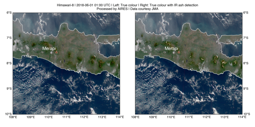
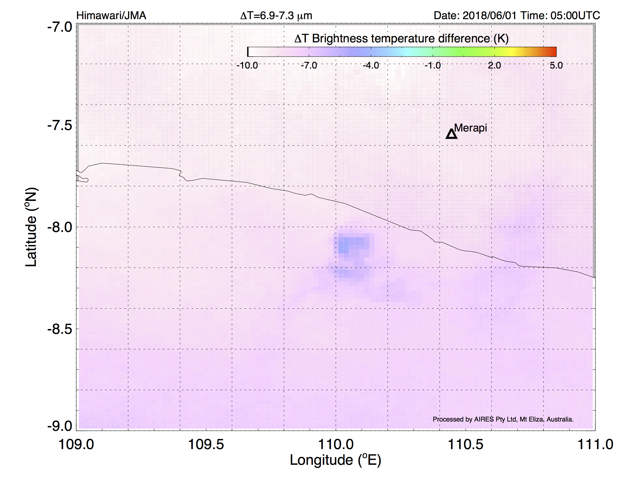
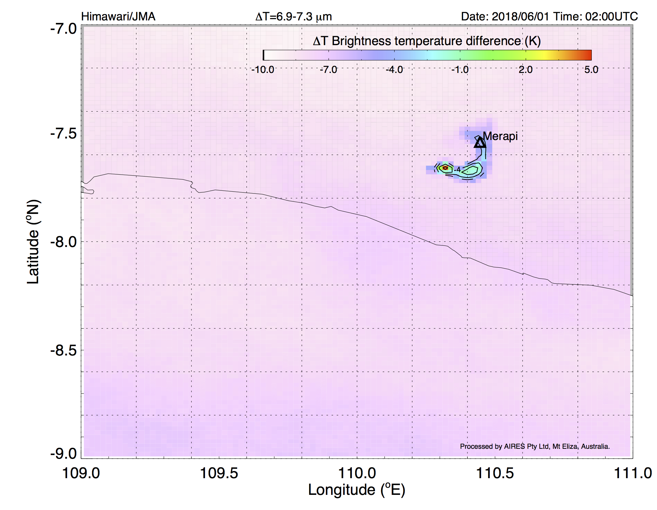
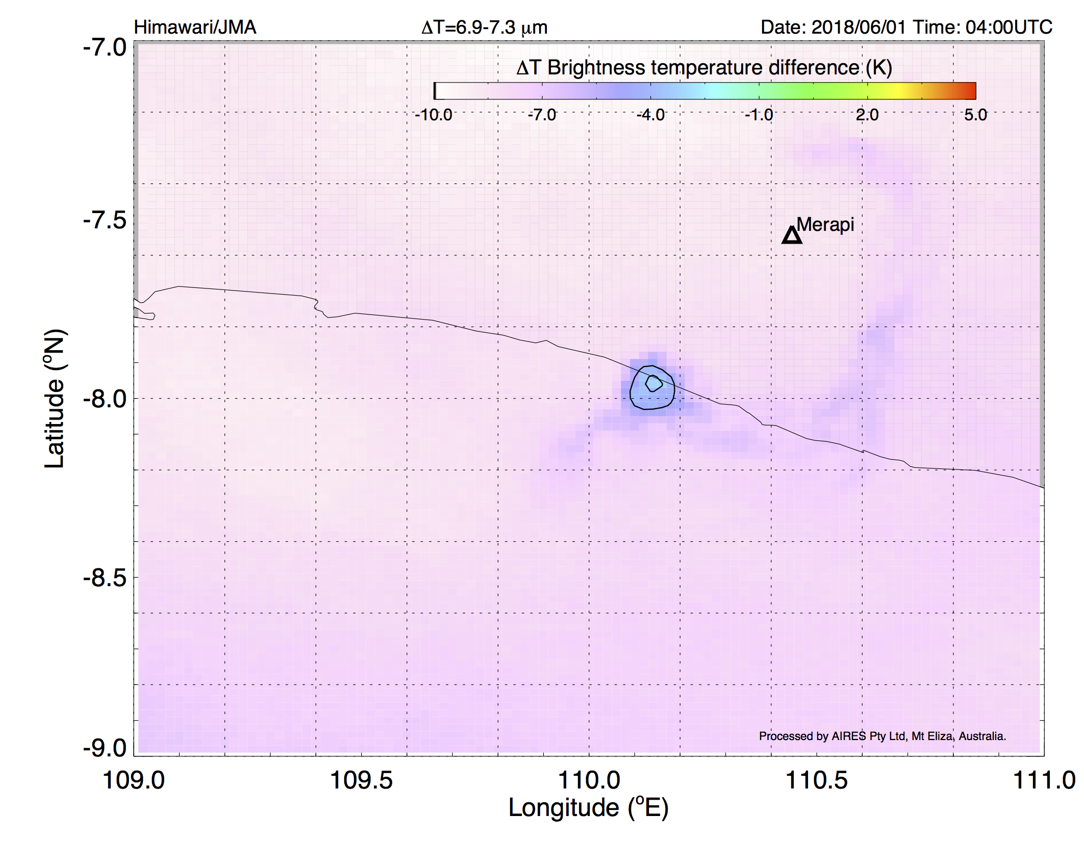
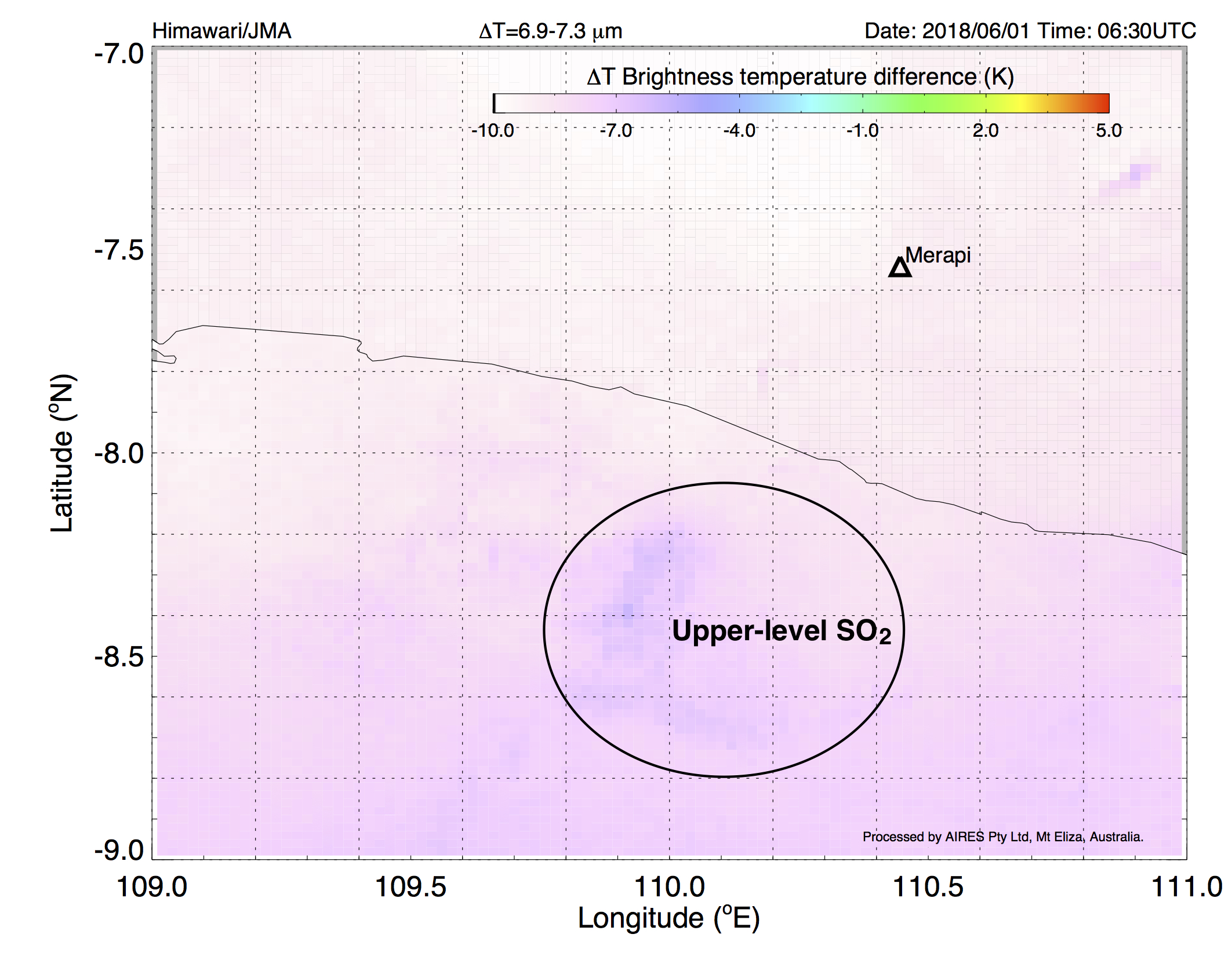
By using the JMA’s Himawari-8 7.3 micron band combined with a channel peaking near 6.9 microns, Himawari can “see” upper troposphere SO2, as this example shows. Gunung Merapi, the “fire mountain” located near the large Indonesian city of Yogyakarta has been erupting for the last few weeks. On 1 June at about 01:20 UTC Merapi produced a moderate-sized (see photo) ash-rich eruption.
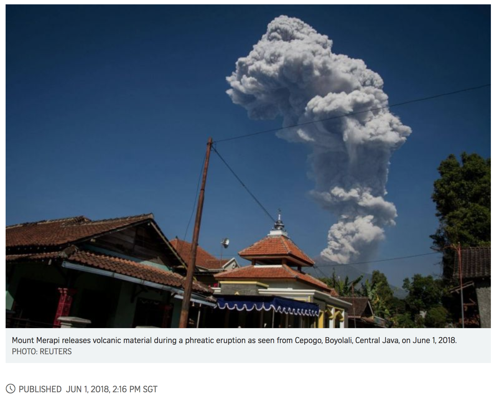
What can’t be seen in the photo is the SO2 gas that the eruption also produced. Our processing of Himawari data reveals this by using channels that are intended to measure mid-upper level water vapour. One channel is situated in the strong 7.3 micron SO2 absorption band and by a judicious choice of channels we can reveal the SO2 while removing some of the water vapour effect.
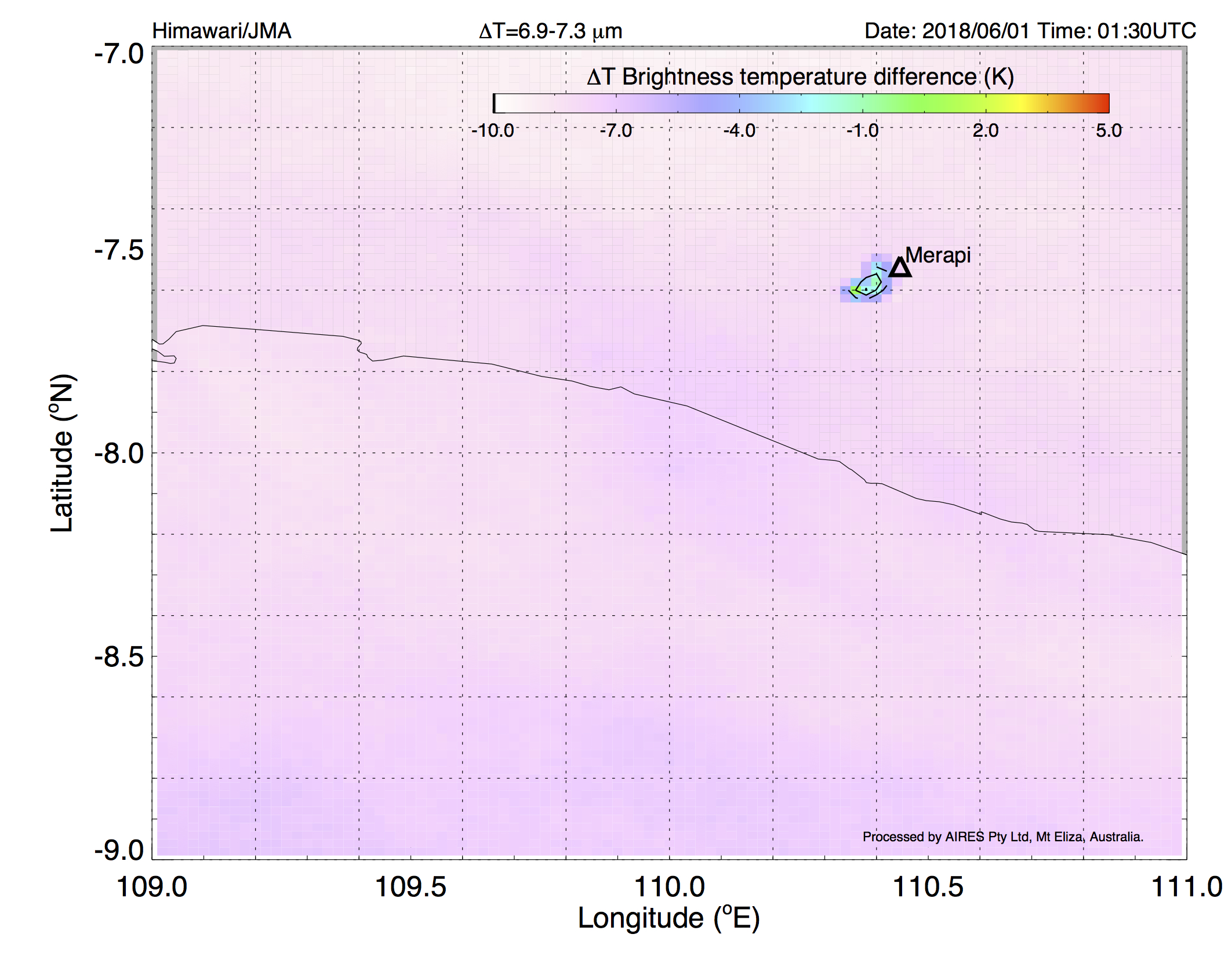
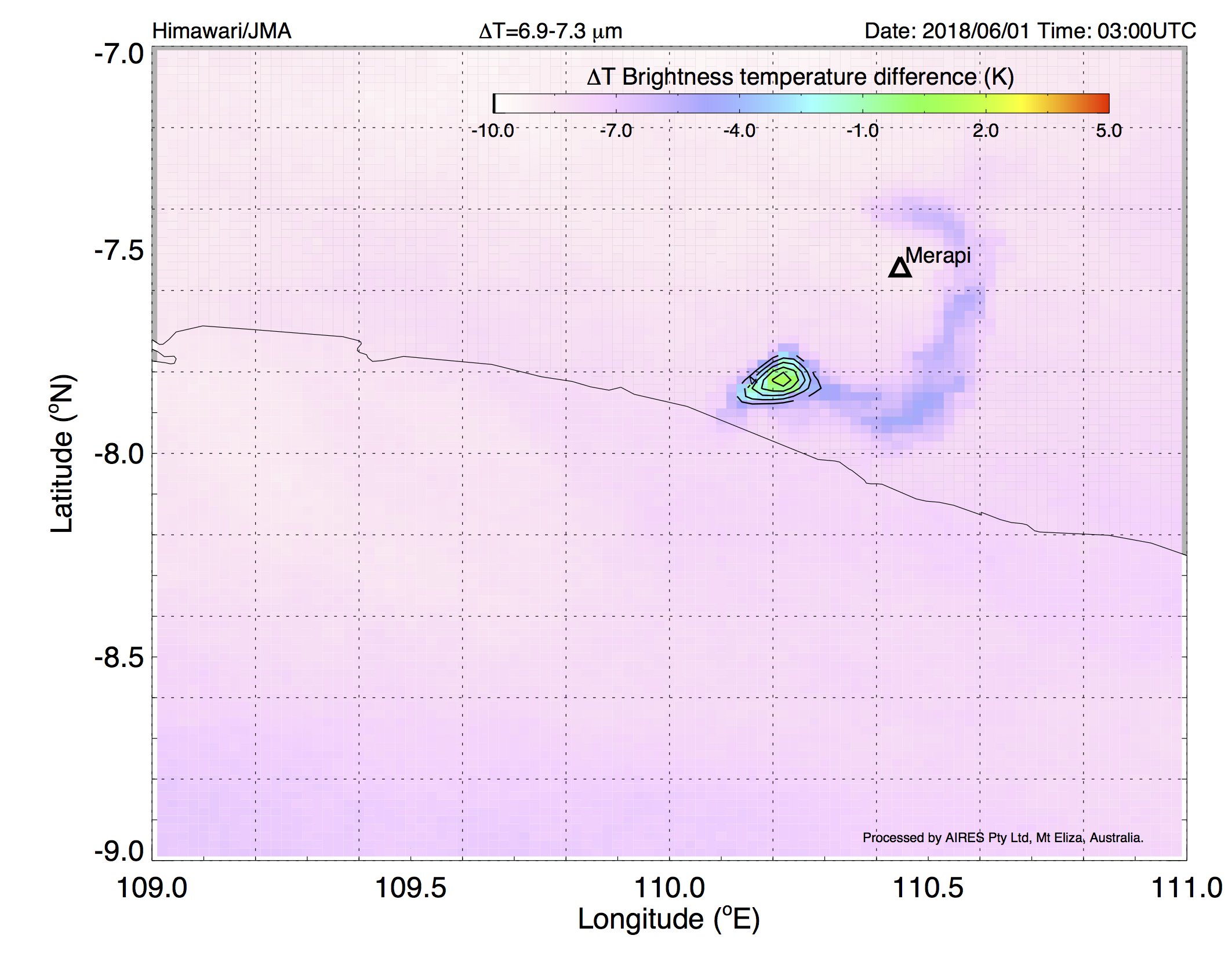
How do we know this is SO2?
We have also analysed data from the AIRS imaging spectro-radiometer that is in operational use to detect SO2. As a polar orbiter with a relatively narrow swath width it can’t get as many “hits” as Himawari.
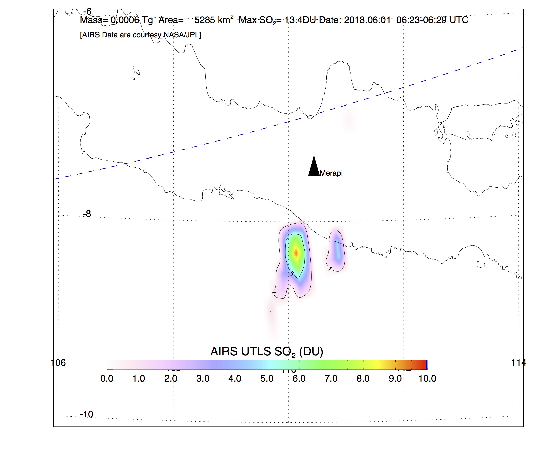
The image shown was acquired at 06:25 UTC on 1 June 2018. There is a small, but noticeable amount of SO2 detected in AIRS. Research on making the Himawari algorithm quantitative is on-going. For now we use this as a tool to detect SO2 and rely on the polar oribiters to provide intermittent, quantifiable retrievals.
These data and data from other satellites are helping us to better understand the way small-sized injections of volcanic SO2 are affecting our atmosphere.
Gunung Merapi
Merapi has a long history of violent volcanic activity. The last large eruption occurred on 26 October ~10:00 UTC,causing the evacuation of ~19,000 people and reported deaths of ~350. The eruption was classed as a ‘100 year’ event. The activity continued on through November 2010 and was analysed extensively using passive and active satellite instruments together with ground based measurements.
AIRES scientists visited the volcano in February 2011 and made ground based measurements using an infrared imaging camera. IR cameras are ideal eruption monitoring instruments because they can be placed at a safe distance from the volcano and operate on a 24/7 basis. Height of eruption, eruption rate as well as identification of ash-rich and/or SO2-rich eruptions is possible using these IR cameras.